

Quick answer
Mount Toubkal is classified as a moderately difficult non-technical climb, accessible to fit hikers without rock-climbing or mountaineering experience. The ascent requires 6-8 hours of sustained uphill walking on the summit day, with altitude reaching 4,167 meters where oxygen levels drop to roughly 60% of sea level. The steepest sections involve loose scree and require surefootedness, but no ropes or technical equipment are needed outside winter months when crampons become mandatory.
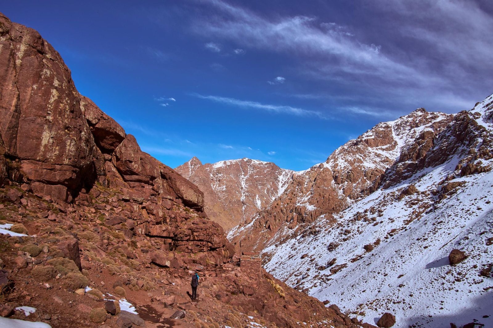
The scree field below the summit pyramid turns back more climbers than any other feature on Toubkal—loose volcanic rock that slides underfoot transforms the final 400 vertical meters into a lesson in efficient movement and mental stamina. How difficult is it to climb Mount Toubkal depends primarily on your aerobic base and acclimatization strategy. The mountain itself presents no vertical rock faces or exposed ridges requiring technical skill. What it does demand is the ability to maintain steady effort for eight to ten hours across two days, first ascending 1,500 meters from Imlil to the Toubkal Refuge at 3,207 meters, then pushing another 960 meters to the summit cairn before reversing the route. The Toubkal ascent rewards cardiovascular endurance over peak strength—you are walking uphill for hours, not scaling cliffs or crossing glaciers outside the winter season. Altitude compounds every physical challenge. At the refuge elevation, reduced oxygen begins affecting sleep quality and morning energy. By the summit, atmospheric pressure has dropped enough that each step requires noticeably more effort than the same movement at sea level. First-time altitude climbers often underestimate this invisible tax on performance. The High Atlas gradient is steep enough that your body has limited time to adapt, which explains why the majority of summit attempts include at least one night at the refuge rather than pushing straight through from the valley floor. The descent tests different systems. Knees absorb repetitive impact for four to five hours on loose trails, and ankle stability becomes critical when fatigue sets in during the final kilometers back to Imlil. Trekking poles reduce joint stress by 20-30%, and proper boot fit prevents the downhill toe-jamming that creates black toenails and blisters. Mandatory guide hire ensures route-finding is handled by someone who knows the mountain in all weather, but the physical work remains entirely your own. Mount Toubkal difficulty sits between a strenuous day hike and an alpine expedition—accessible with proper preparation, humbling without it.
“The scree field below the summit pyramid turns back more climbers than any other feature on Toubkal—loose volcanic rock that slides underfoot transforms the final 400 vertical meters into a lesson in efficient movement and mental stamina.”
How Difficult Is It To Climb Mount Toubkal: The Route Broken Down
The standard Toubkal ascent follows a two-day route: day one climbs from Imlil village to the Refuge Toubkal at 3,207 m, day two summits and returns. Most technical difficulty concentrates in the final 600 m of elevation.
Hike Imlil to Refuge Toubkal
Ascend 1,400 m over 5–6 hours through the Mizane Valley on rocky mule tracks. People underestimate the cumulative elevation gain and arrive at the refuge exhausted, compromising summit-day performance.
Start summit push before dawn
Depart the refuge between 04:00–05:00 to reach the summit by mid-morning. Late starts expose climbers to afternoon cloud cover that obscures the route and increases navigation difficulty.
Cross the south cirque scree field
Traverse unstable scree slopes where every step slides backward; trekking poles become essential. The loose rock magnifies fatigue and triples the effort required compared to solid trail.
Scramble the final summit pyramid
Navigate short Class 2 scrambles over fixed boulders in the last 200 m where hands are needed for balance. Exposure exists on both sides—a slip here means a tumbling fall, not a controlled slide.
Descend via the same route
Return to the refuge, then Imlil, covering 2,400 m of descent in one day. Knee strain intensifies on the scree; controlled steps prevent ankle rolls that end many attempts prematurely.
How Difficult Is It To Climb Mount Toubkal: Altitude and Terrain Facts
The numbers behind Toubkal's ascent explain most of its difficulty. Elevation, not technical climbing skill, is what makes the standard route demanding.
Summit sits at 4,167 meters
Mount Toubkal is the highest peak in North Africa at 4,167m, located in the Toubkal National Park in Morocco's High Atlas range.
Roughly 1,800 meters of elevation gain
Climbers ascending from Imlil (around 1,740m) gain approximately 1,800 vertical meters to reach the summit, most of it on the standard south-side route.
Climb is usually split over two days
Most itineraries break the ascent into two days, hiking to the Toubkal Refuge (around 3,200m) on day one and summiting before descending on day two.
No ropes or crampons needed outside winter
The standard route is a non-technical scramble and trekking path in summer conditions, requiring no ropes, harnesses, or ice axes.
High altitude is the main physical demand
At 4,167m, reduced oxygen levels affect breathing and stamina, making altitude adjustment more relevant to difficulty than the terrain itself.
Refuge stop breaks the altitude gain
The overnight stop at the Toubkal Refuge divides the elevation gain into two more manageable stages rather than a single continuous push.
Final summit push covers steep scree
The last stretch below the summit involves a steep, loose scree slope, the most physically taxing section of the otherwise non-technical route.
Located within a national park
The mountain lies inside Toubkal National Park in the High Atlas Mountains, a protected area established around its highest peaks.
How Difficult Is It To Climb Mount Toubkal in Winter vs Summer
June through September is the most straightforward window to climb Mount Toubkal, since the route is a snow-free trek that mainly demands fitness rather than mountaineering skill. Outside those months, the same route becomes a winter mountaineering objective with a materially higher difficulty rating.
June to September
Peak season, busiest refuges and trailDaytime highs near 20-25°C, cold nights
The standard south-side ascent is a non-technical trek on scree and rock. Fitness and acclimatization are the main limiting factors, not gear or skill.
October and May
Shoulder season, moderate numbersVariable, early snow or lingering snowfields
Conditions swing year to year. Some seasons stay walkable with trekking poles, others already require crampons and an ice axe, so difficulty depends heavily on that year's snowfall.
November to April
Lowest visitor numbersSub-zero at altitude, snow and ice cover
The summit slopes hold snow and ice, and avalanche risk becomes a real factor on the upper mountain. This period calls for crampons, an ice axe, and prior mountaineering experience, shifting the climb from a trek to a winter ascent.
Early morning starts, any season
Fewer climbers on summit push—
Regardless of month, starting early keeps the ascent and descent within safer daylight and temperature windows, which matters more as snow and ice extend the round trip.
Verdict: For a straightforward trek rather than a winter mountaineering route, June through September is the concrete best window to plan around.
How Difficult Is It To Climb Mount Toubkal: What You Need Before You Go
Mount Toubkal requires advance planning for permits, guide hire, and physical preparation well before you reach the trailhead.
-
Book a licensed mountain guide — Moroccan law requires all Toubkal climbers to hire a certified guide for safety and navigation.
-
Arrange your national park permit — Your guide typically handles this, but confirm permit inclusion when booking to avoid trailhead delays.
-
Schedule an acclimatization day in Imlil — Spending 24 hours at 1,740m before ascending reduces altitude sickness risk and improves summit success rates.
-
Pack layered clothing and winter gear — Temperatures drop to -10°C at the summit even in summer; bring insulated jacket, gloves, and thermal layers.
-
Invest in sturdy trekking boots — The scree-covered upper sections demand ankle support and grip that trail runners cannot provide.
-
Bring trekking poles for descent stability — Poles reduce knee strain by 25% on the loose rock sections between refuge and summit.
-
Train with weighted hill walks — Build endurance with 4-6 hour hikes carrying a 7kg pack in the eight weeks before your climb.
Common Mistakes That Make Climbing Mount Toubkal Harder Than It Should Be
Most setbacks on Toubkal stem from pacing errors and ignoring altitude signals rather than technical climbing ability. These avoidable missteps turn a manageable ascent into an exhausting ordeal.
Starting summit day too fast
The refuge sits at 3,200 m—your body needs gradual effort. Walk at conversation pace for the first hour, even if it feels slow, to preserve energy for the final scree slopes.
Ignoring early altitude sickness symptoms
Headache, nausea, or dizziness above 3,000 m are warnings, not discomfort to push through. Descend immediately if symptoms worsen; summit attempts can wait, but altitude sickness cannot.
Underestimating overnight cold at the refuge
Temperatures drop to -10°C in winter and near freezing in summer. Bring a sleeping bag rated for at least -5°C and thermal layers—refuge blankets alone will not keep you warm enough to rest properly.
Wearing trail runners on summit scree
Loose volcanic scree above 4,000 m shreds soft soles and offers no ankle support. Stiff hiking boots with deep tread are necessary for stable footing and descent control.
Attempting the climb without a guide
Moroccan law requires hiring a certified guide. Beyond legal compliance, guides navigate weather changes, recognize altitude sickness early, and know safe descent routes when visibility drops.
Getting to the Mount Toubkal Trailhead From Marrakech
Mount Toubkal National Park sits in the High Atlas Mountains south of Marrakech, and the standard approach starts in Marrakech's Medina or airport before heading overland to the trailhead village of Imlil.
Grand taxi, Marrakech to Imlil (shared or private)
Private transfer via the R203 road, Marrakech to Imlil
Imlil to Sidi Chamharouch and on to the Toubkal Refuge
Mule track continuation beyond Imlil for luggage or riders unable to walk
Mount Toubkal Entrance Fee and Mandatory Guide Costs
Access to Toubkal National Park is officially free of charge. However, climbers are legally required to hire a licensed local guide and obtain necessary permits, which constitute the primary expenses for your ascent.
While the park entrance fee is 0 MAD, your total cost is determined by the mandatory hire of a certified local guide.
Check availability
FAQ: How Difficult Is It to Climb Mount Toubkal?
Everything you need to know about how difficult is it to climb mount toubkal